Beyond the border: Visiting resilient Johnstown
Dave Zuchowski
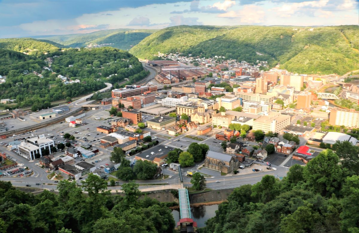
A view of Johnstown from Westmont
Dave Zuchowski
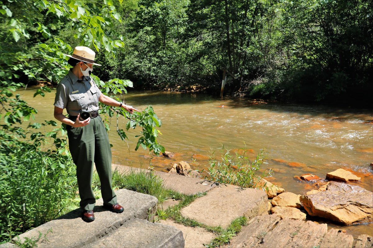
National Park Service ranger Sheila Holliday leads a dam site tour
Dave Zuchowski
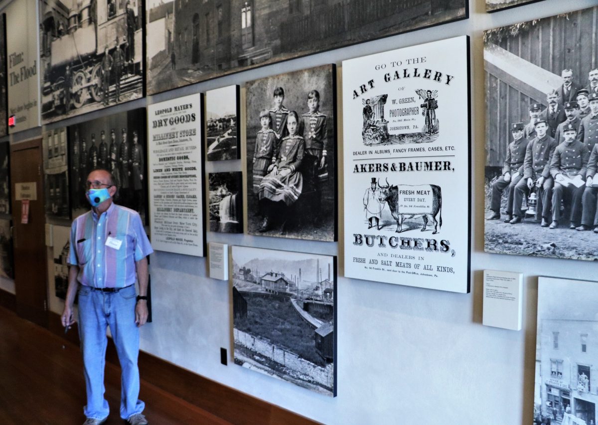
Guided tours of the Johnstown Flood Museum are available.
Enough is enough. A friend and I got more than a touch of cabin fever with all the coronavirus issues making the airwaves the last few months, keeping us housebound and confined. When Governor Wolf moved the state, or most of it, into the green phase of the state’s reopening plan in mid-June, we looked around for an escape, a place close to home that might be a safe bet for a couple days’ getaway.
After searching for someplace close, we chose Johnstown, a place dear to my heart. In 1989, I stood on one of its bridges at 3:10 p.m. on May 31, the 100th anniversary of its disastrous flood. It was an eerie and sad experience, standing there and hearing the sirens and church bells ring, a moving tribute to the lives lost. When the dam upstream broke, millions of gallons of water churned through the canyon and into town.
During the flood’s centennial, I also got to see more of Johnstown and some of its unique attractions. Wanting to see them again after all these years and thinking the small town off the beaten path was safer from the virus than large cities, we packed a few things and headed off to Cambria County.
A bit of history
Early on, Johnstown’s advantageous location along the Pennsylvania Main Line Canal and, later, the Pennsylvania Railroad, contributed to its growth. Starting around 1860, rich coal and iron resources in the area made it and the Cambria Iron Company the leading iron and steel producer in the nation.
In the last quarter of the 19th century, the steelworks produced most of the barbed wire needed by settlers out west, and the plant also manufactured most of the rails needed to build the Transcontinental Railroad. Despite this noteworthy beginning, the town’s most memorable claim to fame came in the form of a disaster, the Great Flood of 1889, which took the lives of more than 2,200 and caused $17 million in damage.
The resilient town bounced back, rebuilt and eventually resumed its steel-making prowess. In 1936 and 1977, two subsequent floods took their toll, and the downturn in the American steel industry in the 1980s substantially impacted the city’s economic base.
Today, the National Park Service administers the Great Flood sites that continue to draw the curious and history buffs. Still, recently the local tourism promoters have begun to focus on the area’s mountainous scenic beauty and a rich trove of recreational activities.
The dam site
Located 14 miles from town, the remains of the South Fork Dam give visitors a look at just how massive the three-mile-long by one-mile-wide Lake Conemaugh had been on May 31, 1889, the date of the dam break. Days of torrential rain and the ensuing fast-rising water alerted the president of the South Fork Hunting and Fishing Club of pending disaster.
Even though workers feverishly tried to enlarge the existing overflow, their efforts proved futile. At 3:10 p.m., the dam broke, and the most significant national calamity of the 19th century was underway when a 60-foot-tall wall of water went thundering down the valley traveling at speeds of up to 40 mph.
The Hunting and Fishing Club
Adjacent to the lake, the village of St. Michael was the site of 16 of the original cottages and 47-room clubhouse built for Pittsburgh elite like Andrew Carnegie and Henry Clay Frick. These men of wealth traveled to the lake to escape the summer heat and smoke of the Steel City.
Although nine of the original cottages still stand and are privately owned, National Park Service rangers offer the clubhouse tours throughout the summer. New this year, the National Park Service is now offering 45-minute long guided tours of the bottom of the dam and the breach. Note that the final section of the hike includes a somewhat steep and strenuous climb. The walks are offered at 11 a.m. and 2 p.m. and meet on the South Abutment. No reservations are required.
Before or after a hike, you might want to stop in the Visitors Center on Lake Road for more information, as well as view the exhibits and 35-minute film titled “Black Friday,” which captures the infamous day’s terror.
The Flood Museum
Downtown, visitors can explore the Johnstown Flood Museum at 304 Washington St. On the main floor, a large multimedia relief map traces the flood’s path. The museum is also is full of photos of the town before and after the flood, artifacts rescued from the debris and related exhibits. In a comfortable theater on the second floor, an award-winning film by Charles Guggenheim screens throughout the day, tracing the events that led up to the dam break, then follows the rushing water down the valley into the helpless town.
The exhibits include an actual prefabricated dwelling used to house those who had lost everything in the flood. Incidentally, Clara Barton led the American Red Cross’s first disaster relief effort, which worked for months in the rescue and rebuilding efforts.
The Stone Arch Bridge
One of several structures to miraculously survive the flood waters’ impact, the 1887 Stone Arch Bridge actually blocked debris from floating further downstream, which then caught fire. Hot flotsam from the mills set the wreckage aflame, burning alive those trapped inside. Today, for three hours each evening, the bridge is floodlit with an array of colors and makes for a spectacular photo op. One of the best places to view the bridge is at Point Park, 100 Washington St. near Point Stadium.
The vehicular inclined plane
After the flood, residents thought it might be advisable to move to higher ground, namely the hilltop community of Westmont, 502 feet above the downtown area. An 896.5 feet foot tall incline opened for the transport of horses, wagons and people in 1891 to get the workers and residents to and fro. Billed as the world’s steepest vehicular inclined plane, the structure has now become a tourist draw that still operates daily. Riders can view the structure’s machinery at the top of their ride, browse the visitor center, and see the surrounding area’s sweeping views from a lofty observation platform.
More in Westmont
On a somber note, the serene and beautiful Grandview Cemetery at 801 Millcreek Road dates back to the late 1800s. Best known for its “Unknown Plot,” the final resting place of the bodies of 777 flood victims who could not be identified after the great flood, the cemetery is open to the public during daylight hours.
On a more pleasant note, the stand of 195 American elm trees that line both sides of shady and stately Luzerne Street constitutes the longest municipally-owned continuous stand of American Elms in the country. Beautiful houses line the noteworthy street that can boast the last cathedral-arched boulevard in the nation.
Recreational options
The Johnstown area has numerous launch sites for kayaks and canoes, and Coal Tubin’ outfitters downtown offers guided white-water rafting and tubing, easy river tubing and bike rentals. Cambria County has more than a half dozen bike trails, including two mountain bike options that start at the top of the incline and head to the downtown area.
Another biking option follows the flood path from the dam break down through the canyon and into Johnstown.
The Heritage Discovery Center
To learn more about Johnstown’s residents and their ancestors, head over to the Heritage Discovery Located at 201 Sixth Ave. The Center allows visitors to interactively experience what it was like to be a new immigrant to the steel town. It also allows guests to investigate the city’s steel-making heritage and explore a new exhibit that travels in time from the area’s early days of agriculture and canal transport through its rail, coal and iron and steel heyday.
The third floor has an expansive children’s section that enables young visitors to experience the inside of a replica coal mine, amble through a rooftop garden and put their creativity to the test by building a dam, staging a fashion show and more.
For more information on Johnstown, call the visitor’s center at 1-800-237-8590 or visit visitjohnstownpa.com.