Anyone’s guess on snowfall amount

The uncertainty over how much snow will fall in Washington and Greene counties this weekend is throwing a curveball at road crews and emergency responders preparing for the storm.
Lee Hendricks, a meteorologist with the National Weather Service in Pittsburgh, said the heaviest accumulation will likely hit south of Interstate 70 between Friday night and Saturday morning.
Greene and Fayette counties are in a winter storm watch during that time and likely will receive at least six inches of snow, he said, although southern Washington County could experience similar snowfall.
He cautioned the forecast could change as the storm moves closer to the area, but he expects the dividing line to be the I-70 corridor.
“The track the storm is on right now, there can be significant changes,” Hendricks said. “There’s a fairly sharp cutoff on this, and trying to nail the exact line of the cutoff is difficult.”
That concerns Washington County Public Safety Director Jeff Yates, who was preparing Wednesday inside the cavernous public safety office in Courthouse Square.
He said they’re monitoring the situation using forecasts from the National Weather Service, a private weather data provider and the Pennsylvania Emergency Management Agency.
“We’re still in the area of greatest uncertainty,” he said. “It depends on how the storm tracks.”
Yates has been in touch with municipalities, schools, hospitals and police and fire departments, sending updates as they become available. He also has been posting information on the Washington County Department of Public Safety’s Facebook page, which has about 4,000 followers and is open to anyone.
Two additional workers will be staffing the county’s 911 emergency dispatch center starting at 3 p.m. Friday. In addition, emergency generators for the Courthouse Square office building are routinely tested weekly.
“We reviewed some of our plans, and we’ve been checking our generators to make sure they’re all fine,” Yates said. “Hopefully, there won’t be much to talk about.”
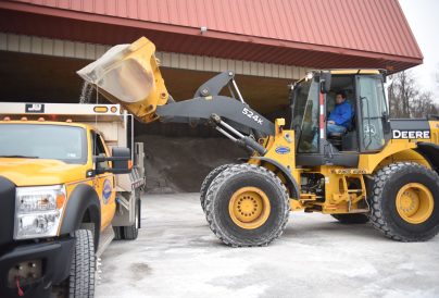
The forecast has the state Department of Transportation’s road crews ready to be flexible and target the hardest-hit areas. PennDOT spokeswoman Valerie Petersen said road crews will clear the interstates first and then move to secondary state highways.
She asked that motorists be patient as crews treat the roads, especially when the heaviest snow is falling. The expected time frame of the storm over the weekend should aid in that effort, with fewer cars on the road, Petersen said.
“Of course we won’t know until it hits, but our crews are prepared,” Petersen said. “We are watching (the forecasts) and progressing to fit our needs. If there is a lot of snow and it’s coming down hard, it won’t matter what anyone does. It’s one of those scenarios where you do the best you can.”
She urged people to stay off the roads if possible, or check for traffic updates at www.511PA.com. The website offers traffic cameras and real-time information on road conditions. New for this season is a map that allows readers to click on the “plow truck” tab at the top of the map to locate where crews are working on the interstates.
Meanwhile, the crews are ready for anything in Waynesburg, where the heavier snowfall is expected, borough Manager Mike Simms said.
“We have a full bin of salt, and our equipment is 100 percent ready to go,” Simms said. “So hopefully, we’re prepared for whatever Mother Nature throws at us.”

