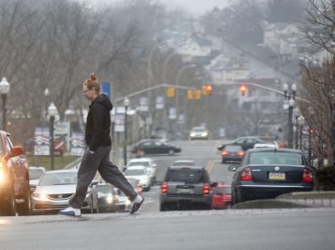
The big storm that wasn’t

Lee Hendricks wasn’t snowed under by what was coming.
“The system drew up the coast a little quicker than expected and drew a lot of cold air from Canada behind it. When that happens, that pretty much kills a chance of precipitation.”
In other words, the Atlantic storm destined to pound the northeastern U.S. wasn’t encountering that Canadian air in a way that would create a major accumulation in Southwestern Pennsylvania.
Hendricks is a meteorologist with the National Weather Service’s Pittsburgh station, and he was responding to questions Tuesday morning as to why regional residents mostly did not wake up to a winter wonderland – as many had anticipated – while Philadelphia, Boston, New York City and Providence were being assaulted by, perhaps, winter’s final thrust.
He wasn’t surprised by the relatively dry conditions hereabouts.
“Models have been trending the past three days showing progressively less (snow) amounts forecast for our area,” Hendricks said from the NWS center in Moon Township. “The most we gave was a weather advisory for the region, except the mountains. We weren’t looking for stupendous amounts of snow – maybe three to six inches over a 24- to 30-hour period (beginning about 8 p.m. Monday).
“That’s really not enough snow to trigger a winter storm watch across the region.”
Not that the local weather service’s domain escaped unscathed. The Pittsburgh station serves Southwestern Pennsylvania and parts of West Virginia, Ohio and Maryland, and areas to the east and south – particularly at higher elevations – were hit. Hendricks said that as of 9 a.m. Tuesday, parts of Preston County (W.Va.) had seven to 10 inches of snow; Tucker County (W.Va.) and Garrett County (Md.) four to 10; Everett (Bedford County) nine and Berlin (Somerset County) five.
Washington and Greene counties, he added, were clear at that time while Morgantown, W.Va., had less than an inch.
“This forecast was extremely complicated,” said Kristin Emery, a meteorologist with KDKA-TV CBS Pittsburgh. “From late last week on, computer models showed us to expect zero to once inch or the highest scenario of up to a foot of snow depending on the track of the coastal low. That ended up moving farther inland than expected and the energy from the west fizzle and moved farther south of us than the model predicted. Basically, the middle of the road solution always looked most likely with around three to six inches forecast for our area. It looked closer to the six inches by Sunday night but by Monday night, the 3-inch solution was becoming more clear.”
“We may still end up with around three inches in spots by later (today),” she added, “while the forecast held true for eight inches or more in the Laurels and Ridges.”
Emery said a “pocket of dry air” was the reason why a significant amount of snow failed to accumulate across Washington and Greene counties.
“The full situation was very complicated, but wound up allowing very narrow bands of snow to stay in place just to our east and our west,” Emery said. “So communities in Eastern Ohio got two to three inches of snow by daybreak as well as places like Garrett County, Md., and Preston County, W.Va. seeing three-to-four inches by early morning. Those snow bands just kept going while that finger of dry air evaporated our moisture and kept snow from forming over Washington, Greene and Allegheny counties until late morning.”
Christine Kindl, spokeswoman for California University of Pennsylvania, lives near Ligonier in eastern Westmoreland County – a higher elevation. “We got a nice couple of inches there,” she said after arriving at her work space. “It’s a lot different from what New York City is experiencing right now.”
Cal U. has a meteorology program that is well regarded. It offers a bachelor’s degree in Earth science with a concentration in meteorology. Daulton Lochran, a freshman from Cleveland, is pursuing that area of study, which, he said, is essentially an imperfect science.
“People are thinking, ‘Why didn’t we get that much snow?’ It’s the uncertainty of the forecast. It can’t be 100 percent accurate. A slight variable can affect what happens.”
Lochran said the colder air from the north, which passed through this region, tends to have “a drier effect.” It went to the south and east and met with the warm, moist air of the nor’esaster, resulting in heavier snowfalls in the Northeast.
By early afternoon, however, the snowstorm was abating across eastern Pennsylvania and parts of the Northeast. The state lifted vehicle and speed restrictions it had placed on interstates west of I-81 (the Carlisle area), including the turnpike between Bedford and Carlisle.
Although spring is a mere five days away, the local forecast for the rest of the week doesn’t inspire serious thoughts that April showers bring May flowers. A low of about 15 degrees with wind chills around 0 were expected Tuesday night, and highs in the mid-20s are anticipated today, with wind chills at about 10. Hendricks said temperatures aren’t expected to reach the upper 40s until Monday.
That is not a positive outlook, but he admitted that life as a meteorologist is as imperfect as the vocation itself.
“You need to have thick skin,” Hendricks said, laughing mildly.

